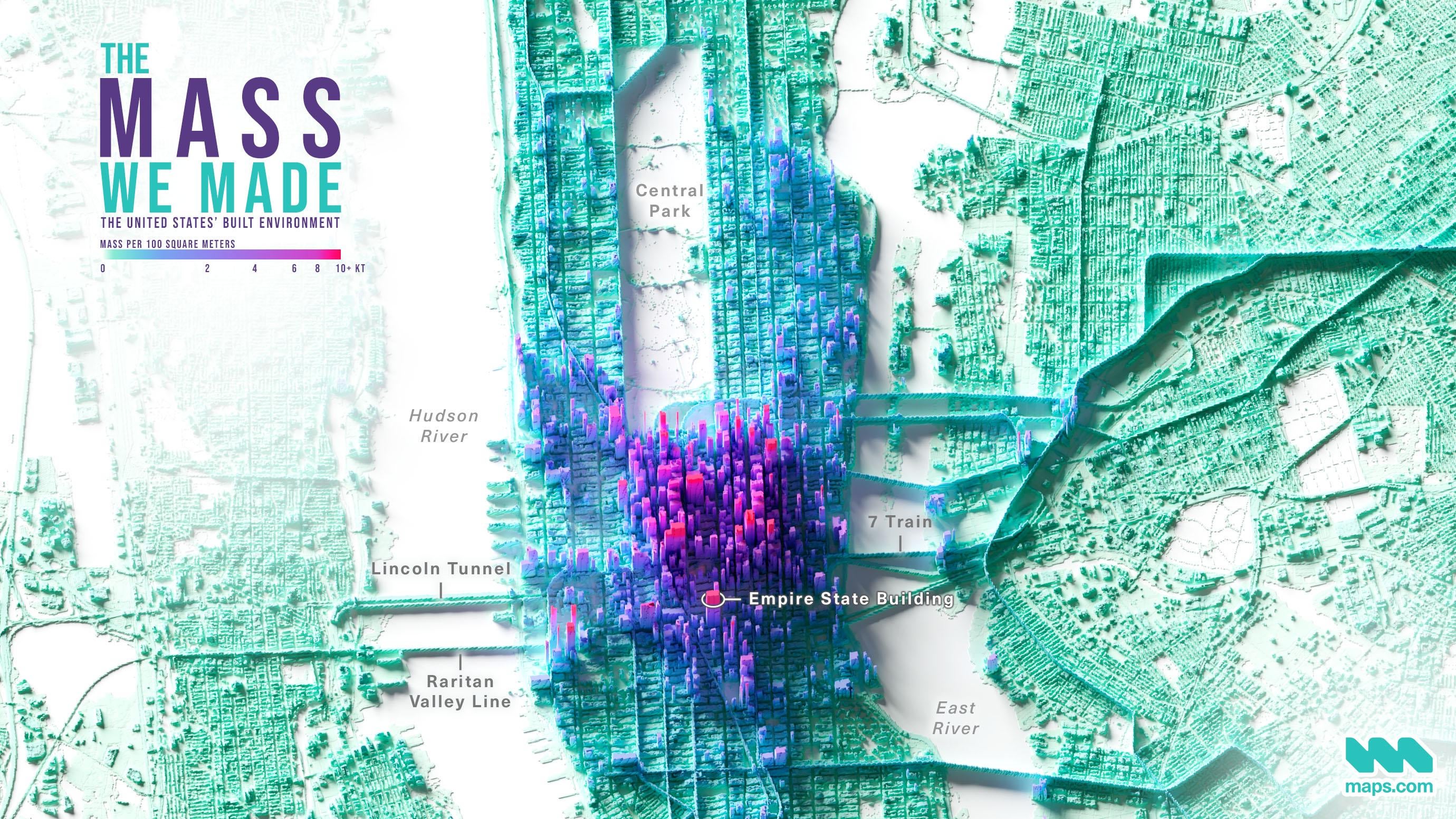
The Mass of the Built Environment around New York City [OC] Posted by jscarto Tags:DataData Is BeautifulDataIsBeautiful 1 comment Data: [Frantz, D., et al. (2023)](https://www.nature.com/articles/s41467-023-43755-5) Tools: ArcGIS Pro, Blender In this map, height and color represents the mass of the built environment (buildings, roads, tunnels, bridges, etc) and not the actual height of the structure(s). More info, including a high-res render of the contiguous United States: https://www.maps.com/the-mass-we-made-mapping-the-weight-of-the-built-environment/ Leave a ReplyYou must be logged in to post a comment.
Data: [Frantz, D., et al. (2023)](https://www.nature.com/articles/s41467-023-43755-5) Tools: ArcGIS Pro, Blender In this map, height and color represents the mass of the built environment (buildings, roads, tunnels, bridges, etc) and not the actual height of the structure(s). More info, including a high-res render of the contiguous United States: https://www.maps.com/the-mass-we-made-mapping-the-weight-of-the-built-environment/
![The Mass of the Built Environment around New York City [OC]](https://www.europesays.com/wp-content/uploads/2024/08/tc96daafyeld1-1920x1024.jpeg)
1 comment
Data: [Frantz, D., et al. (2023)](https://www.nature.com/articles/s41467-023-43755-5)
Tools: ArcGIS Pro, Blender
In this map, height and color represents the mass of the built environment (buildings, roads, tunnels, bridges, etc) and not the actual height of the structure(s).
More info, including a high-res render of the contiguous United States: https://www.maps.com/the-mass-we-made-mapping-the-weight-of-the-built-environment/