
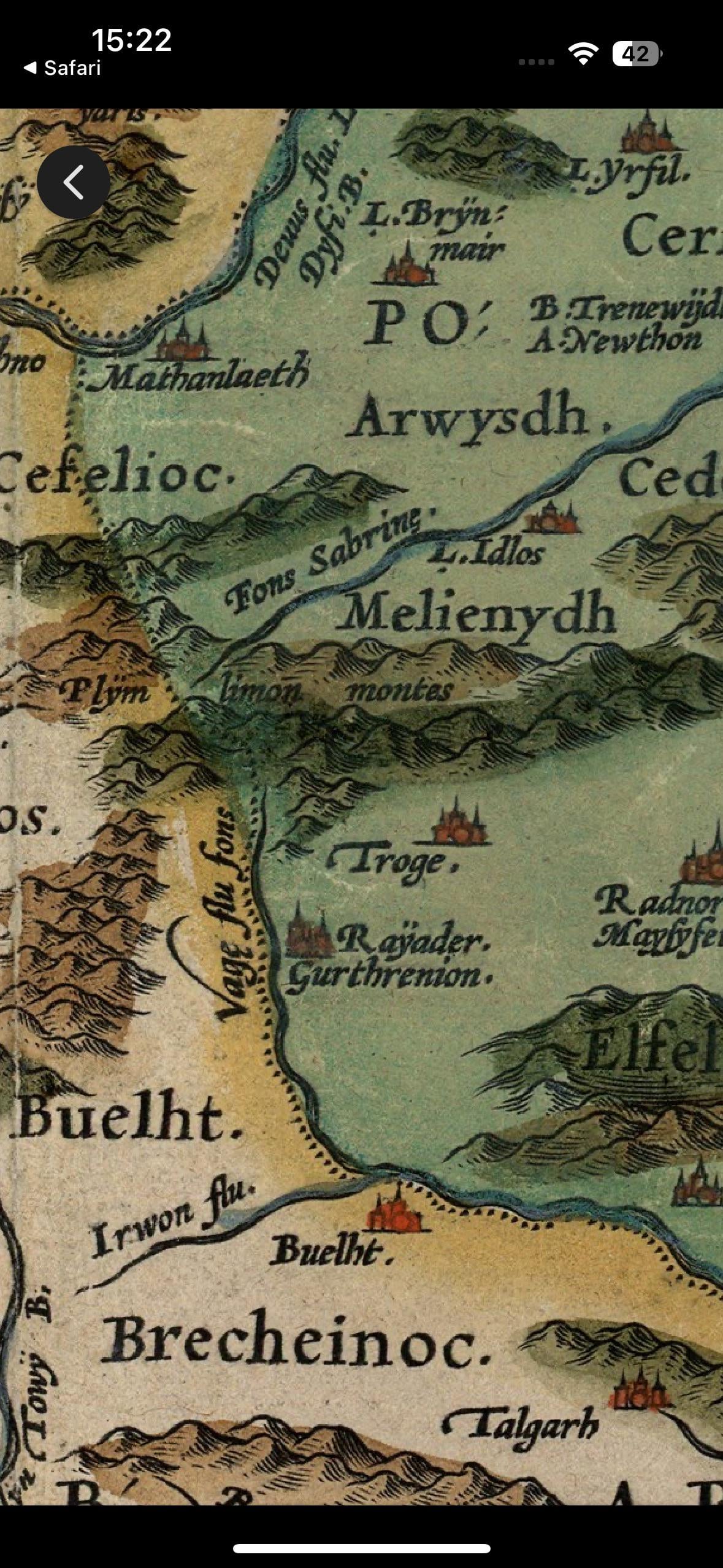
I recently stumbled across the Cambriae Typus map at the National Library of Wales and came across a town/ settlement on the map called Troge around Rhayader/ Llanidloes area. Could someone shed some light on where this might be today?
by MaleficentStop7733
4 comments
Looks in about the right place for Llangurig? There’s not much in the way of settlements between there and Ponterwyd.
Possibly Crossgates or Fron, which are both *Y Groes* in Welsh? This is the same map that renders Bristol as ‘Brightstowe’ and Criccieth as ‘Chrychieth’, so ‘Y Groes’ to ‘Troge’ doesn’t seem like a huge leap. I suppose the question is whether the villages were significant when the map was produced in 1573.
The area is identified as ‘Llanbadern’ on [John Speed’s map of Radnorshire](https://artlogic-res.cloudinary.com/w_2400,h_2400,c_limit,f_auto,fl_lossy,q_auto/artlogicstorage/themaphouse/images/view/1622ea3fab53cba3057b9f788d59ad43j/themaphouse-john-speed-radnorshire-1616.jpg), which as I understand it is the name of the ecclesiastical parish (as Llanbadarn Fawr) and now the modern community in which both villages lie.
For anyone else trying to puzzle it out [[map link](https://www.library.wales/discover-learn/digital-exhibitions/maps/maps-of-wales/cambriae-typus)] – the geography isn’t accurate at all, but the settlement seems to be between Rhayader, Radnor, Presteigne (Prestain), and Llanidloes (which can been seen abbreviated as ‘L. Idlos’ above ‘Melienydh’), below the Pumlumon massif and east of the River Wye but west of the Lugg.
Lovely map. Nice to see Buallt there.
That’s a blydi big Post Office at Arwysdh.
It’s up towards Llangurig, but off to the east a little; maybe closer to Abaty Cwm-Hir?