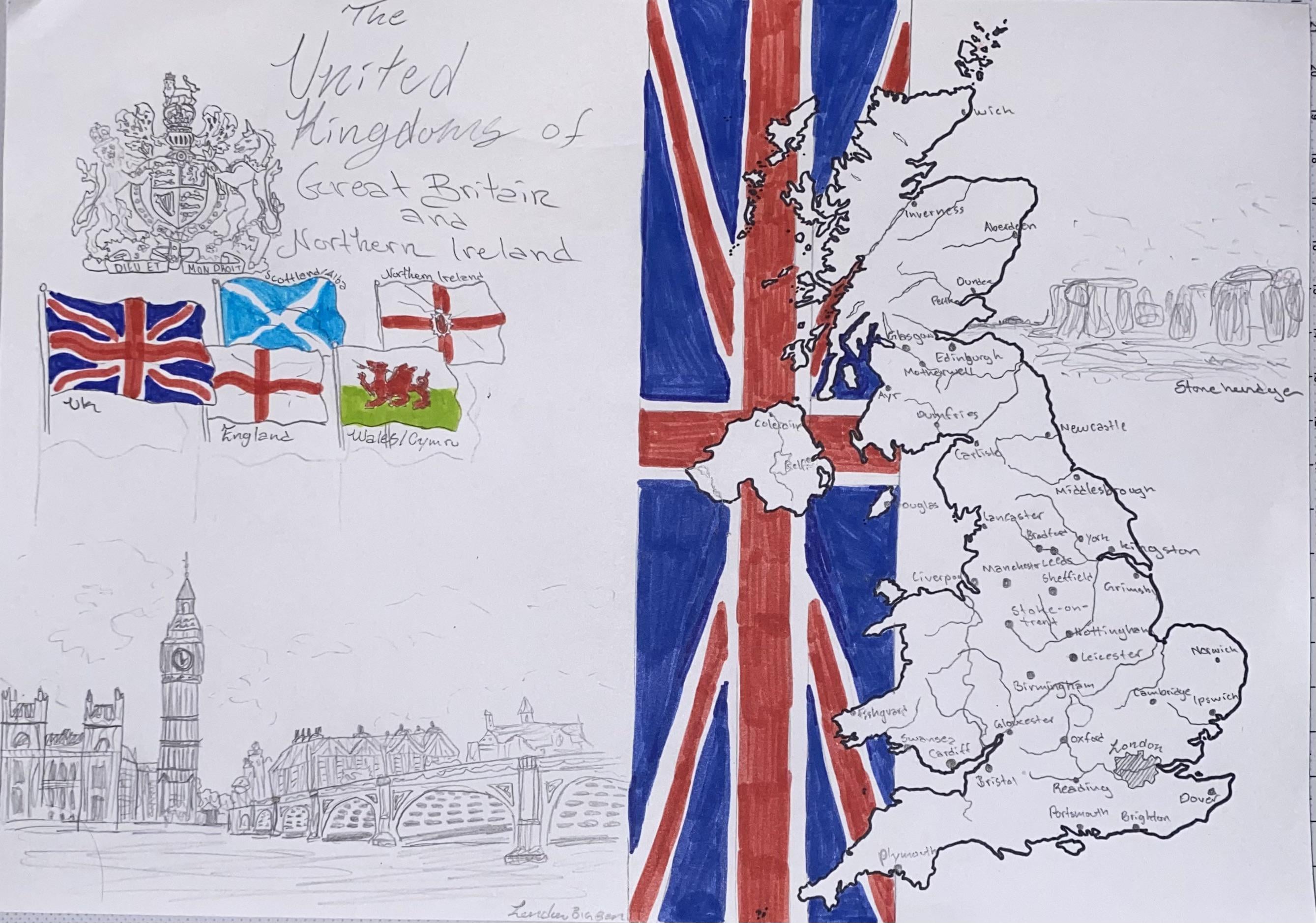
Hate to nitpick, but you do seem to have Dover about 30 miles inland though! :p
Hand of Ulster ✋️
Poor Holyhead…
lmao. The people of Exeter are gonna be so pissed that Plymouth made it on and they didn’t
Kingdom…s?
Wow this is phenomenal! Great work!
Issue with northern ireland, you should have done some more inland so it takes up some space because it looks empty and coleraine isnt bad but a better choice would be Londonderry or Magherfelt but they are very long place names so its alright.
I hate to nitpick but it *is* “The United Kingdom of Great Britain and Northern Ireland” not “The United Kingdom**s** of Great Britain and Northern Ireland”, and it’s “Stonehenge” not “Stone hendge”.
I’m sorry. I love your picture of the Houses of Parliament. But those stood out to me.
Pretty good effort!
However you’ve managed to include the Isle of Man which isn’t part of the UK and omitted the Shetland Islands which are.
![Hand drawn map of the United Kingdom [oc]](https://www.europesays.com/wp-content/uploads/2024/09/g0kn673cnerd1-1920x1024.jpeg)
9 comments
That’s genuinely impressive… well done.
Hate to nitpick, but you do seem to have Dover about 30 miles inland though! :p
Hand of Ulster ✋️
Poor Holyhead…
lmao. The people of Exeter are gonna be so pissed that Plymouth made it on and they didn’t
Kingdom…s?
Wow this is phenomenal! Great work!
Issue with northern ireland, you should have done some more inland so it takes up some space because it looks empty and coleraine isnt bad but a better choice would be Londonderry or Magherfelt but they are very long place names so its alright.
I hate to nitpick but it *is* “The United Kingdom of Great Britain and Northern Ireland” not “The United Kingdom**s** of Great Britain and Northern Ireland”, and it’s “Stonehenge” not “Stone hendge”.
I’m sorry. I love your picture of the Houses of Parliament. But those stood out to me.
Pretty good effort!
However you’ve managed to include the Isle of Man which isn’t part of the UK and omitted the Shetland Islands which are.