We are live tracking the rapidly developing typhoon Kong-Rey, which is on its way to a significant impact on Taiwan on the last day of October this week. Weather models suggest that Kong-Rey will be a devastating storm, with a huge storm surge, heavy rain, flooding, and destructive winds for the country.
Note: This post is regularly updated as the system evolves. The most recent update is always at the top of the article. Feel free to bookmark the link and stay tuned.
Impressive large eye seen on visible satellite at sunset
Update: Oct 29th, 10:00 UTC
Local Tuesday evening’s visible satellite image revealed that Typhoon Kong-Rey is rapidly intensifying. The image shows impressive upper-level outflow ventilation and a large eye surrounded by explosive convection within the eyewall.
![]()
![]()
The system is expected to continue its explosive development overnight and continue on Wednesday towards its peak intensity before beginning its impact on Taiwan on Thursday, October 31st.
Major flooding and damaging winds are likely with Kong-Rey as it reaches Taiwan
Update: Oct 29th, 08:00 UTC
The main impact of typhoon Kong-Rey will be a huge amount of rainfall on Thursday and Friday, leading to a high risk of widespread flooding across eastern Taiwan’s complex mountainous terrain. High-resolution models suggest 600-1000 mm of rain will be possible.


The highest wind intensity is likely to stay to the east-southeast of Taiwan as the system peaks before the landfall and impact on Taiwan. However, the wind field will be very large, damaging winds expanding far away from the center, and the storm surge will be huge.
The ICON-EU model suggests that sustained winds will be more than 140 knots (260 km/h or 160 mph). Part of this wind field will also blast the east-northeast coast of Taiwan.
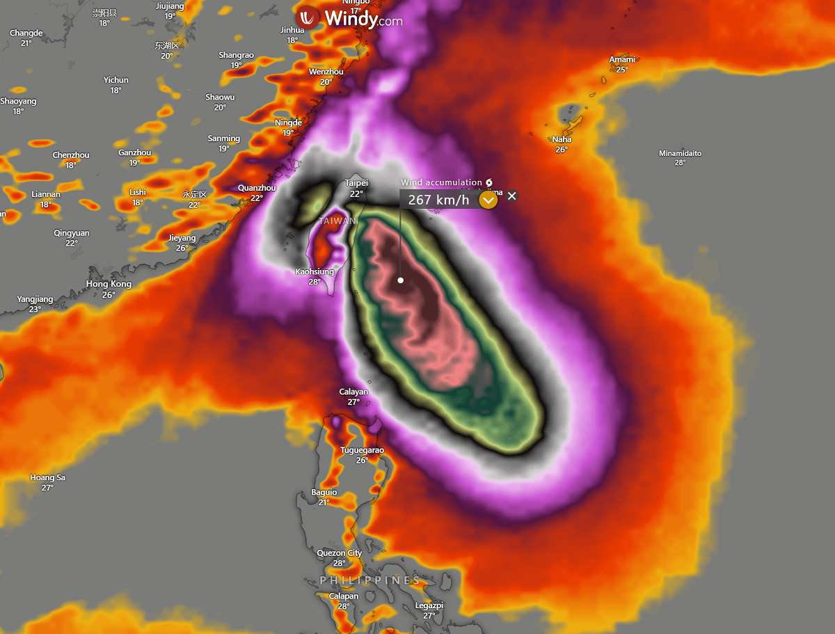

Kong-Rey is expected to cross Taiwan on Thursday, significantly weakening as it crosses the high terrain, before heading towards the second impact the next day in eastern China.
Forecast track of typhoon Kong-Rey hints a direct hit to Taiwan on Thursday
Update: Oct 29th, 06:00 UTC
The Joint Typhoon Warning Center (JTWC) predicts that Kong-Rey will continue its track towards the west-northwest on Tuesday, then gradually shift towards the northwest through Wednesday and Thursday.
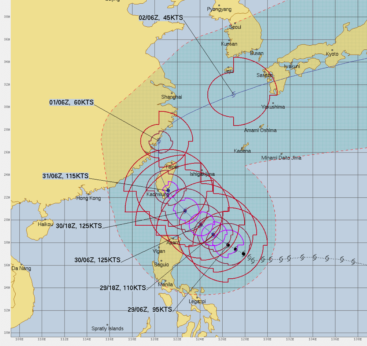

The latest satellite analysis indicates sustained winds of 95 knots (180 km/h or 110 mph), with the central pressure below 950 mbar. The typhoon is entering a more rapid intensification phase now. Forecasts suggest peak intensity will be at least 125 knots.
Here is a video animation of the GFS weather model prediction of Kong-Rey as it heads toward Taiwan and China in the following days.
The impact on Taiwan will be significant on Thursday!
Very high sea temperatures in the Western Pacific will support the explosive development of Kong-Rey
Update: Oct 29th, 02:00 UTC
Aligned with well-above-normal sea temperatures around the globe, the Western Pacific is also overheating. Sea temperatures around 30 °C are spread to the east of the Philippines, where typhoon Kong-Rey is ongoing. Just shy lower temperatures are also observed along the future track of the system towards Taiwan.
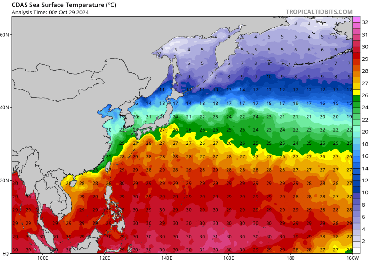

This indicates that Kong-Rey is expected to rapidly intensify soon and take advantage of these warmer-than-normal water temperatures. Tropical systems gain much strength when sea temperatures are 30 °C or higher.
A new typhoon, Kong-Rey, forms in the Western Pacific and becomes a very large storm
Update: Oct 29th, 00:00 UTC
We are now tracking another tropical system—a rapidly developing typhoon, King-Rey, in the western Pacific Ocean. The water vapor satellite imagery reveals its huge structure, suggesting it will become a very large typhoon in the coming days.
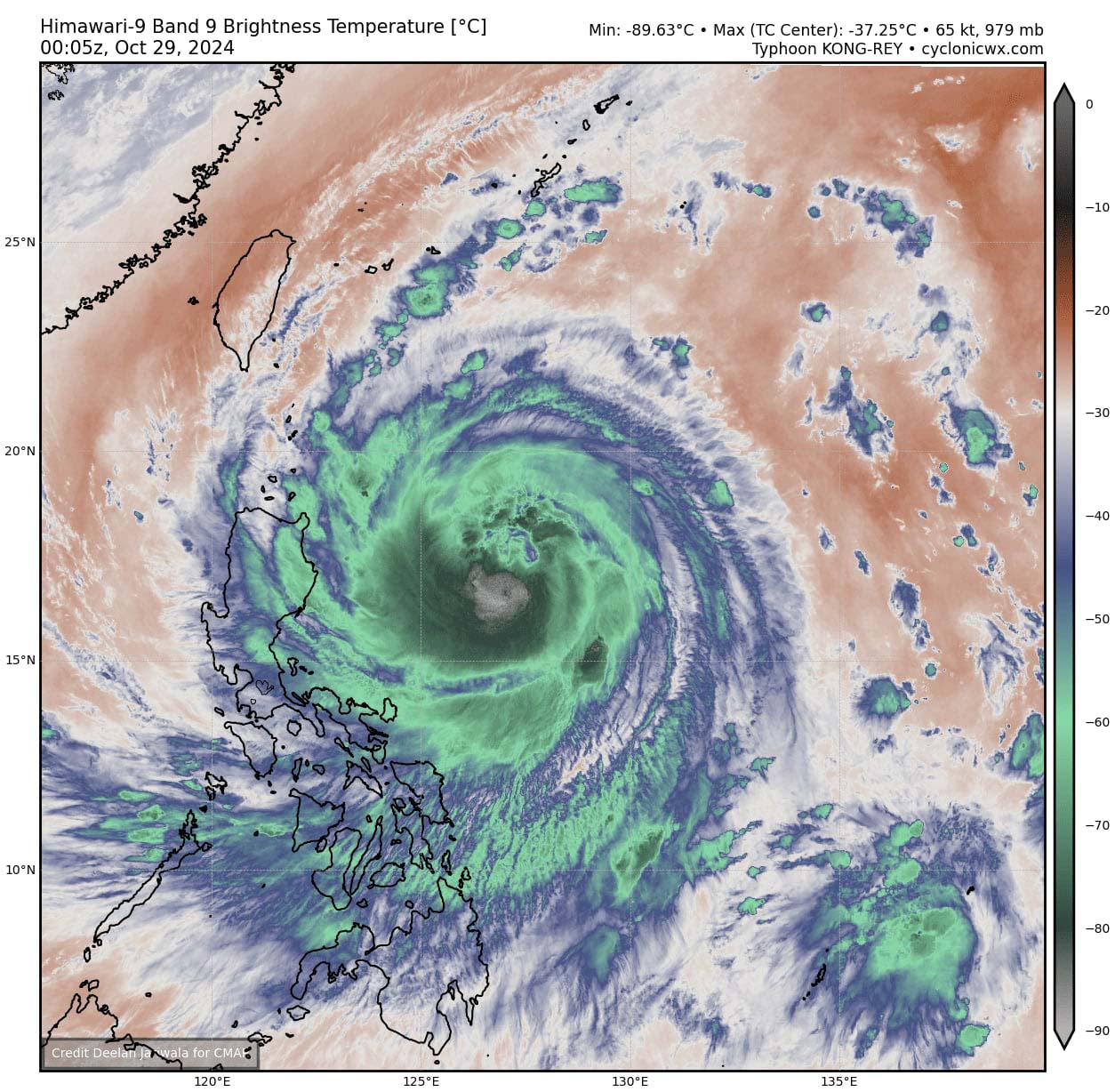

There’s extensive and powerful upper-level outflow ventilation across all four quadrants, meaning the typhoon has near-ideal conditions for explosive development over the next 48 hours as it tracks toward Taiwan.
Windy and CyclonicWX provided images to use in this article.
See also: Storm Ashley’s impact on Ireland and Scotland on Oct 20th